Smith River Complex North update for Thursday, September 8, 2023
Norm McDonald, Incident Commander, Alaska Interagency Incident Management Team
Dave Bales, Incident Commander, Southwest Area Incident Management Team 2
Start date: Aug 15, 2023
Location: Wild Rivers Ranger District
Cause: Lightning
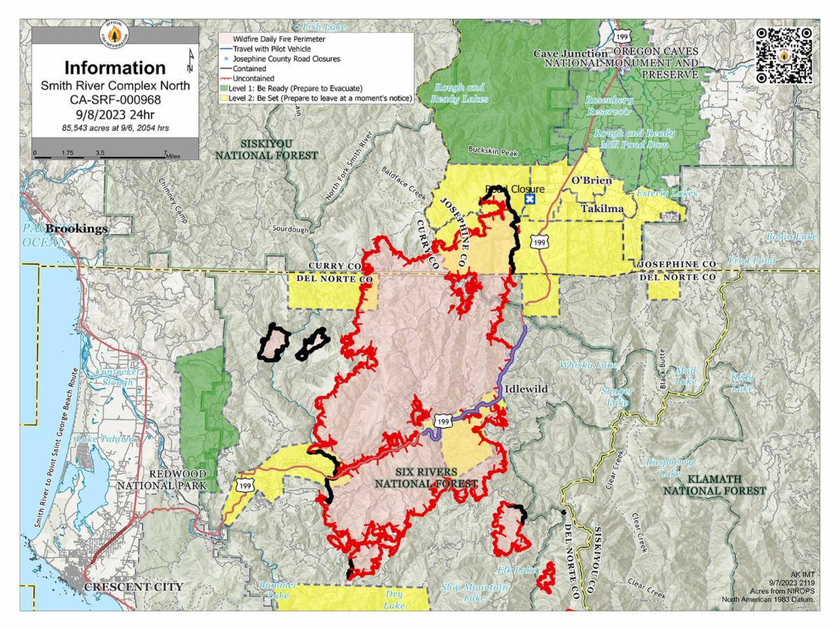
Acres: 85,700/10,276 in Oregon
Containment: 19 percent
Personnel: 2,338 for Complex
GRANTS PASS, OR – After ignition of a test fire near the northern edge of the Smith River Complex, firefighters initiated strategic burning operations on the north end of the fire area near Forest Road 019. The operation was considered successful, aided by favorable weather conditions and low intensity fire behavior. This work is an important step toward reducing fuels and increasing containment levels.
On the northwest side of the fire, crews continue to work on preliminary steps for a potential contingency line near Forest Road 1107, scouting for a helispot, removing brush along the road, and using heavy equipment. Firefighters are also still monitoring and improving containment lines on the east side of the fire in the Monkey Ridge area.
Weather conditions are expected to continue much like the last few days, with warm temperatures and light breeze. Firefighters will continue to evaluate opportunities to implement additional strategic burning operations for the next several operational periods.
Please respect the temporary flight restriction (TFR) established for the Smith River Complex; keep drones away from firefighting operations. If you fly, we can’t. Don’t be the reason a firefighting air mission has to divert! For more information on the TFR, visit https://tfr.faa.gov.
US-199 is open to all traffic but hazards from fire damage remain along the highway. One-lane pilot car traffic may cause delays of 20 to 60 minutes. The Del Norte Sheriff’s Office is asking residents to refrain from any unnecessary travel along that route. Firefighting apparatus and emergency responder traffic will be heavy throughout the day, please use extreme caution. For additional information on road conditions, please see the Caltrans site and Oregon Department of Transportation's TripCheck site.
Monitor Rogue Valley Emergency Management site and sign up for evacuation alerts and updates at the link below. An interactive Fire First Response Map showing evacuation areas can also be found there.
The Rogue River-Siskiyou National Forest and Bureau of Land Management Coos Bay District have issued area and road closures for the Smith River Complex. A campfire ban remains in place for BLM and forest lands, and the Wild section of the Rogue River. Visit the forest website at link below or https://www.blm.gov/orwafire for additional information.


No comments:
Post a Comment
Note: Only a member of this blog may post a comment.