Fire size: 910 acres Location: Glacier Peak Wilderness, 36 miles northwest of Entiat, WA Start date: June 13, 2025 Cause: Lightning Fuels: Dead and down timber
Wenatchee, WA – The Pomas Fire is actively burning in dead and down timber in steep terrain in the Glacier Peak Wilderness. Winds continue to spread the fire which has moved north into Ice Creek and northeast into Aurora Creek just west of Borealis Peak. The fire behavior includes spotting and group tree torching along with active backing and flanking activity. Fire personnel continue to assess and look for opportunities to use containment lines that were used in past fires in the vicinity. Aviation resources are being utilized as needed. A Temporary Flight Restriction is in effect over the fire area. Please do not fly drones in this restricted air space. Crews will be wrapping key infrastructure, such as the Myrtle Lake bridge, with protective fire-resistant materials over the next few days. People driving on the Entiat River Road will see an increase in fire personnel on that road, please slow down and drive carefully. Although the forecast is for cooler temperatures, large amounts of dead timber in the area, west winds, and low humidity with critically low fuel moistures will continue to challenge safe and effective firefighting efforts. Smoke: Smoke has been blowing down the Entiat Valley drainage and over into the Lake Chelan area. Smoke is also visible from Holden Village and Lake Chelan areas as well as the Trinity/Chiwawa area. For more information on smoke and air quality please visit: https://wasmoke.blogspot.com/ Closures: The Glacier Peak Wilderness on the Entiat Ranger District, including Ice Lakes, is now closed for fire operations and public safety. Mrytle Lake access is also closed. The fire is 12 air miles from the Pacific Crest Trail and currently poses no threat to that trail. Specific trail closures include: - Trail #1400 (ENTIAT RIVER TRAIL)
- Trail #1404 (COW CREEK TRAIL)
- Trail #1404A (MYRTLE LAKE TRAIL)
- Trail #1430A (LARCH LAKE HIKER TRAIL)
- Trail #1430 (LARCH LAKES TRAIL)
- Trail #1408 (GARLAND PEAK TAIL) from the saddle south of Fifth of July Mountain to the junction with Trail #1453
- Trail #1453 (POMAS PASS TRAIL)
- Trail #1405 (ICE CREEK TRAIL)
- Trail #1230 (SNOWBRUSHY TRAIL) from the junction with Trail #1400 to Milham Pass
- Trail #1432 (45 MILE DRIVE TRAIL)
- Trail #1434 (DUNCAN HILLL TRAIL) from the wilderness boundary to the junction with Trail #1230
- Trail #1435 (ANTHEM CREEK TRAIL)
- Trail #1433 (PYRAMID MOUNTAIN TRAIL) from Saska Pass to the junction with Trail #1230
- Trail #1431 (COOL CREEK TRAIL)
- Trail #1231 (WILSON CREEK TRAIL)
Evacuations: None, there are no structures or homes threatened at this time. Fire Information: Updates will occur when there is significant new information on this Wilderness fire. -End- | 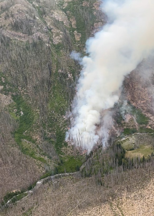

No comments:
Post a Comment
Note: Only a member of this blog may post a comment.